

Rugged GPS units with glove‑friendly controls, solid offline maps, long battery life and secure mounts top the list for adventure motorcycle navigation in 2026. Standout models include the minimalist Beeline Moto II, Garmin zūmo XT (5.5″) for bright on/off‑road mapping, Garmin Zumo 396 for Adventurous Routing and GPX support, Garmin Montana 700 for multi‑GNSS and topo maps, plus Carpuride W702PRO and LAMTTO 7″ for wireless CarPlay/Android Auto. This guide compares features, mounts and power options to help choose the best unit for your rides.
| Beeline Moto II Motorcycle GPS Tracker (Black) |

| Distraction-Free Rider | Navigation Capability: Turn-by-turn mini-map navigation with ETA, speed, distance | Display / Interface: Compact mini-map display, glove‑friendly controls | Durability / Weather Resistance: IP67 waterproof; shockproof design | VIEW LATEST PRICE | Read Our Analysis |
| Garmin zūmo XT All-Terrain Motorcycle GPS (5.5″) |
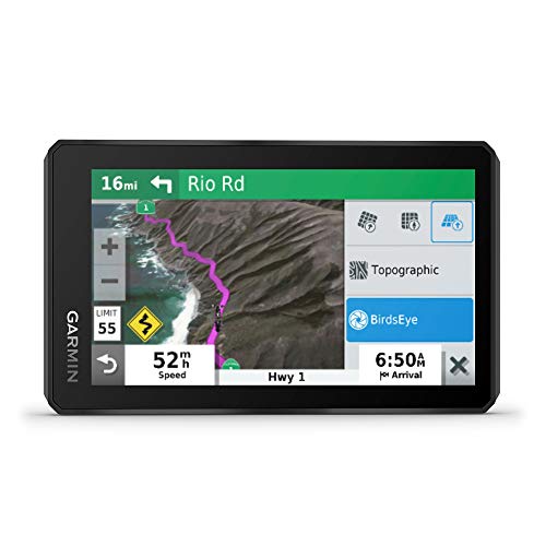
| Best for Off‑Road | Navigation Capability: On‑road and off‑road turn-by-turn routing (Garmin Adventurous Routing) | Display / Interface: 5.5″ ultrabright glove‑friendly touch display (landscape/portrait) | Durability / Weather Resistance: Rain‑resistant rugged construction; MIL‑STD‑810 drop tested | VIEW LATEST PRICE | Read Our Analysis |
| Garmin Zumo 396 LMT-S Motorcycle GPS |

| Adventure Touring Favorite | Navigation Capability: Turn-by-turn navigation with Adventurous Routing; GPX support | Display / Interface: 4.3″ sunlight‑readable glove‑friendly display | Durability / Weather Resistance: Rugged, weather‑resistant (fuel/UV/weather resistant) | VIEW LATEST PRICE | Read Our Analysis |
| Garmin Montana 700 Rugged GPS Handheld (5″ Touchscreen) |

| Versatile Trail Companion | Navigation Capability: Routable road and trail navigation with multi‑GNSS support | Display / Interface: 5″ glove‑friendly touchscreen | Durability / Weather Resistance: MIL‑STD‑810 rugged, water/shock/vibration rated | VIEW LATEST PRICE | Read Our Analysis |
| Carpuride W702PRO 7″ Motorcycle CarPlay & Android Auto |

| Best Infotainment Hub | Navigation Capability: Smartphone navigation via wireless CarPlay/Android Auto (maps/apps) | Display / Interface: 7″ waterproof touchscreen with ambient light sensor | Durability / Weather Resistance: 7″ waterproof touchscreen; reverse‑protection power design | VIEW LATEST PRICE | Read Our Analysis |
| LAMTTO 7″ Wireless Motorcycle CarPlay & Android Auto |

| Wireless Connectivity Pick | Navigation Capability: Smartphone navigation via wireless CarPlay/Android Auto (maps/apps) | Display / Interface: 7″ IPS touchscreen with anti‑glare sun visor, glove‑compatible | Durability / Weather Resistance: IP67 waterproof; wide operating temperature range | VIEW LATEST PRICE | Read Our Analysis |
More Details on Our Top Picks
Beeline Moto II Motorcycle GPS Tracker (Black)
If you want a compact, distraction-free navigator that keeps your eyes on the road, I’d recommend the Beeline Moto II — it’s built for riders who value simple, reliable guidance on commutes, scenic detours, or long adventures. I like its mini-map showing speed, distance, and ETA at a glance, and planning routes in seconds for curvy, scenic, or fastest options. The interface stays clear, controls work with gloves, and the sleek black casing suits any bike. It’s IP67 waterproof and shockproof, and a USB-C battery lasts up to 14 hours, so it endures real-world rides.
- Navigation Capability:Turn-by-turn mini-map navigation with ETA, speed, distance
- Display / Interface:Compact mini-map display, glove‑friendly controls
- Durability / Weather Resistance:IP67 waterproof; shockproof design
- Connectivity:USB‑C charging; pairs with phone for planning (implied)
- Route Planning / Sharing:Ride planning (curvy/scenic or fastest) and route creation
- Power / Battery or Power Options:USB‑C rechargeable battery — up to 14 hours
- Additional Feature:Mini-map distraction-free display
- Additional Feature:Glove-friendly physical controls
- Additional Feature:USB-C 14‑hour battery
Garmin zūmo XT All-Terrain Motorcycle GPS (5.5″)
I recommend the Garmin zūmo XT for riders who want a tough, glove-friendly GPS that handles both paved twisties and rough 4×4 tracks. I like its 5.5″ ultrabright HD touch display that works in landscape or portrait and stays usable with gloves and rain; the unit passed MIL-STD-810 drop testing. It ships with on-road and off-road topo maps, public land boundaries, and 4×4 roads, plus BirdsEye imagery without subscription. Adventurous Routing finds curvy roads. You get spoken directions to your helmet, route sharing, live traffic/weather via Garmin Drive, track recording, sync with Garmin Explore, music streaming, and essential mounts/cables.
- Navigation Capability:On‑road and off‑road turn-by-turn routing (Garmin Adventurous Routing)
- Display / Interface:5.5″ ultrabright glove‑friendly touch display (landscape/portrait)
- Durability / Weather Resistance:Rain‑resistant rugged construction; MIL‑STD‑810 drop tested
- Connectivity:Bluetooth phone/helmet audio, Garmin Drive app, Wi‑Fi/ANT options
- Route Planning / Sharing:Plan/share routes, record tracks, sync via Garmin Explore
- Power / Battery or Power Options:Motorcycle power cable included; device powered while mounted (internal battery unspecified)
- Additional Feature:BirdsEye satellite downloads
- Additional Feature:Landscape/portrait orientation
- Additional Feature:MIL‑STD‑810 drop tested
Garmin Zumo 396 LMT-S Motorcycle GPS
You’ll appreciate the Garmin Zumo 396 LMT-S if you prioritize twisty, scenic rides — I recommend it for riders who want adventurous routing that seeks curvy, hilly backroads instead of long stretches on highways. I like its 4.3-inch sunlight-readable display and rugged, glove-friendly design built to resist fuel vapors, UV and harsh weather. Adventurous Routing favors curves over highways and GPX support lets me share routes for group rides. Pairing with my phone gives hands-free calling, smart notifications and Live traffic and weather via the free Smartphone Link app. It’s a compact, durable navigator made for spirited motorcycling.
- Navigation Capability:Turn-by-turn navigation with Adventurous Routing; GPX support
- Display / Interface:4.3″ sunlight‑readable glove‑friendly display
- Durability / Weather Resistance:Rugged, weather‑resistant (fuel/UV/weather resistant)
- Connectivity:Smartphone pairing for calls/Smartphone Link live services
- Route Planning / Sharing:GPX support for sharing routes; track saving
- Power / Battery or Power Options:Device designed for motorcycle power with internal battery (runtime not listed)
- Additional Feature:4.3″ sunlight-readable screen
- Additional Feature:Fuel-vapor resistant design
- Additional Feature:GPX file sharing support
Garmin Montana 700 Rugged GPS Handheld (5″ Touchscreen)
For riders who want a tough, glove-friendly navigator that won’t quit on long trips, I recommend the Garmin Montana 700 for its rugged MIL‑STD durability and a 5″ touchscreen that’s 50% larger than the previous model. I like its multi‑GNSS support (GPS, GLONASS, Galileo) and preloaded TopoActive maps for both roads and trails. The 3‑axis compass and barometric altimeter keep navigation precise off‑road. ANT+, Wi‑Fi, Bluetooth and direct BirdsEye downloads make data sync easy, and Garmin Explore plus Connect IQ expand functionality. Versatile mounts and glove-friendly display mean I can navigate confidently in harsh conditions.
- Navigation Capability:Routable road and trail navigation with multi‑GNSS support
- Display / Interface:5″ glove‑friendly touchscreen
- Durability / Weather Resistance:MIL‑STD‑810 rugged, water/shock/vibration rated
- Connectivity:Wi‑Fi, Bluetooth, ANT+ for syncing and apps
- Route Planning / Sharing:Manage waypoints/routes/tracks via Garmin Explore and apps
- Power / Battery or Power Options:Rechargeable handheld with multiple power/mounting options (battery supported)
- Additional Feature:Multi‑GNSS support
- Additional Feature:Barometric altimeter sensor
- Additional Feature:Connect IQ app support
Carpuride W702PRO 7″ Motorcycle CarPlay & Android Auto
If I had to pick a single reason to recommend the Carpuride W702PRO, it’d be its seamless wireless CarPlay and Android Auto that keeps navigation, calls, and music hands-free so riders can stay focused on the road. I like the 7″ waterproof touchscreen with ambient light sensing — visibility and reduced eye strain matter on long rides. Dual Bluetooth lets me pair phone and helmet, while BT Trans supports rider-passenger intercom and music sharing within ~10 m. Built-in compass and barometer add useful navigation context. Power options are flexible but heed USB output limits; firmware needs smaller TF cards.
- Navigation Capability:Smartphone navigation via wireless CarPlay/Android Auto (maps/apps)
- Display / Interface:7″ waterproof touchscreen with ambient light sensor
- Durability / Weather Resistance:7″ waterproof touchscreen; reverse‑protection power design
- Connectivity:Dual Bluetooth, wireless CarPlay/Android Auto, helmet audio
- Route Planning / Sharing:Route guidance via CarPlay/Android Auto apps (phone‑based sharing)
- Power / Battery or Power Options:Two power options: 12V motorcycle power line or USB (requires ≥5V,2.5A)
- Additional Feature:Dual Bluetooth + intercom
- Additional Feature:Reverse polarity protection
- Additional Feature:64GB TF local storage
LAMTTO 7″ Wireless Motorcycle CarPlay & Android Auto
I recommend the LAMTTO 7″ Wireless Motorcycle CarPlay & Android Auto for riders who want seamless, glove-friendly navigation and media control on the road. I like its wireless CarPlay/Android Auto and dual Bluetooth so you can pair a phone and helmet headset for hands-free calls and audio. The 7-inch IPS touchscreen stays responsive with gloves, has an anti-glare visor, and presents Waze and other maps clearly. Siri and Google Assistant handle messages, route changes, and music without touching the phone. With IP67 waterproofing and -4°F to 158°F operation, it’s built for real-world adventure conditions.
- Navigation Capability:Smartphone navigation via wireless CarPlay/Android Auto (maps/apps)
- Display / Interface:7″ IPS touchscreen with anti‑glare sun visor, glove‑compatible
- Durability / Weather Resistance:IP67 waterproof; wide operating temperature range
- Connectivity:Dual Bluetooth, wireless CarPlay/Android Auto, voice assistant
- Route Planning / Sharing:Route guidance via CarPlay/Android Auto apps (phone‑based sharing)
- Power / Battery or Power Options:Vehicle power compatible; operating temperature spec (internal power support)
- Additional Feature:Anti‑glare sun visor
- Additional Feature:Wide operating temperatures
- Additional Feature:Glove‑friendly IPS touchscreen
Factors to Consider When Choosing a GPS for Adventure Motorcycle
When selecting a GPS for adventure motorcycling, the rider must weigh durability and weatherproofing, navigation accuracy and map coverage, and reliable battery life or power options. Equally important are display size and daytime visibility plus secure, ergonomic mounting that withstands rough terrain. These factors determine whether the unit performs dependably on long, varied routes.
Durability And Weatherproofing
Routinely exposed to mud, rain, drops, and sustained vibration, an adventure motorcycle GPS must combine rugged construction with reliable sealing to remain functional on long rides. Buyers should prioritize IP67/IP68 ingress protection and MIL‑STD‑810 or equivalent shock, thermal, and vibration certification to guarantee survival in rain, mud, impacts, and temperature extremes. Shockproof housings and reinforced or vibration‑isolating mounts reduce failure from constant engine and trail vibration. Screen protection—sunlight‑readable, scratch‑resistant glass such as Gorilla Glass—maintains legibility in direct sun and high temperatures. Sealed ports, corrosion‑resistant connectors, and waterproof USB‑C or dedicated power leads prevent water ingress and electrical faults. Finally, confirm the operating temperature range (for example −20°C to 60°C) plus UV and fuel‑vapor resistance for reliability in deserts, alpine zones, and near engines.
Navigation Accuracy & Maps
Precision matters: navigation accuracy and the quality of onboard maps determine whether a rider stays on course, finds safe lines, and reliably returns to planned waypoints in remote terrain. Select units with multi-GNSS support (GPS, GLONASS, Galileo) and high-sensitivity receivers plus WAAS/EGNOS to reduce dropouts and achieve 1–3 m horizontal accuracy where conditions permit. Check real-time position refresh (higher Hz) and fine track-recording resolution for smoother logs during fast, technical sections. Confirm support for detailed routable topo and off‑road maps—contours, trails, public‑land boundaries—and GPX import/export for precise planning and sharing. Prioritize devices that permit offline local map storage and direct-to-device satellite imagery downloads so map detail and positional fidelity persist when cellular service is absent.
Battery Life And Power
On long rides, battery life and power management determine whether a navigator finishes a route or needs to improvise; choose units offering at least 10–12 hours of internal runtime or reliable external-power options to avoid mid-ride failure. Devices should charge via standard USB-C or 12V motorcycle power and include over-voltage and reverse-polarity protection. Check input amperage requirements so unexpected shutdowns don’t occur when using motorcycle outlets or power banks. Prefer quick-charge support or high-capacity internal batteries (roughly 3,000–6,000 mAh equivalent) so brief stops meaningfully extend operation. Favor models allowing simultaneous charging and use, with clear on-screen battery level and runtime estimates. For remote expeditions, prioritize low-power modes, removable/replaceable batteries, or compatibility with external packs and solar panels for redundancy.
Display Size And Visibility
A clear, appropriately sized display is essential for safe navigation on an adventure motorcycle: screens between about 4″ and 7″ balance legibility with unobstructed sightlines, while high-brightness (800+ nits) or transflective panels maintain contrast in direct sun. The ideal unit pairs sufficient resolution (720p or better on larger screens) so route lines, waypoints and text stay sharp when zoomed. Glove-friendly touch response or dedicated physical controls are vital because thick gloves and wet conditions make small targets difficult to tap. Viewing angles and anti-glare coatings affect readability from typical riding positions and when the device is tilted. Prioritise a display that remains visible in varied light without dominating the cockpit, ensuring quick glances convey needed information.
Mounting And Ergonomics
Mounting and ergonomics determine how effectively a GPS integrates into the rider’s cockpit, balancing accessibility, durability, and sightlines so navigation becomes a seamless part of riding. Select mounts with secure, vibration-damping attachments—engineered rubber isolators or dampening collars—to protect the unit from bumps and extend lifespan. Position the device within easy thumb reach and line of sight, typically centered above the triple tree or slightly right, enabling glances without head movement. Confirm touchscreen or control usability with gloves and choose mounts offering adjustable tilt and rotation for ideal angle and reachable buttons. Verify waterproofing and locking mechanisms on both mount and device, and prefer quick-release, tool-free removal for charging or theft prevention. Finally, check handlebar clearance, clamp compatibility, weight support, and potential mirror or wind-resistance issues.
Connectivity And Integration
Many riders expect a modern adventure GPS to do more than map routes — it must seamlessly connect to helmets, phones, sensors, and cloud services. The unit should support Bluetooth and/or ANT+ for helmet audio, phone pairing, and external sensors (TPMS, heart-rate), ensuring voice prompts and calls route directly to the comms system. Wi‑Fi and cellular capability—built‑in or via a paired smartphone—enable map updates, live traffic/weather, and direct-to-device imagery downloads without a PC. Smartphone app integration that syncs routes, tracks, waypoints, and notifications allows planning on phone or computer and seamless transfer to the device. GPX/KML import-export and common sharing protocols are essential for exchanging data with riders and third‑party planners. Confirm USB-C, motorcycle power harness compatibility, accessory ports, and over‑the‑air firmware/map updates.
Route Planning And Recording
When planning routes and capturing rides, the ideal adventure GPS supports GPX/KML import‑export, reliable multi‑GNSS tracking with configurable fix intervals, and on‑device tools for editing or following tracks so riders can both prepare complex itineraries and recover from course deviations without a computer. Devices should read/write common file formats to import planned routes, share waypoints, and export rides to mapping tools. Track recording needs configurable 1–10 second fixes, robust internal storage or microSD support for multi‑day logs, and strong antenna performance for accuracy in canyons, forests, or under overhangs. On‑device route editing, snapping to roads/trails, and native GPX track following (breadcrumb or turn‑by‑turn) simplify course corrections. Bluetooth, Wi‑Fi, or USB syncing plus companion apps enable planning on larger screens and backing up ride metrics.